Hampton Wick: Brick by Brick Series
Hampton Wick lies in a strategic position on the River Thames. For five hundred years its bridge was the only fixed crossing between London and Staines. Its connections with the ancient town of Kingston on the opposite bank and the presence of the nearby Royal Palace of Hampton Court brought prosperity and the village grew from a hamlet of around 500 souls in 1750 to a peak of 3,400 in 1951.
Hampton Wick: Brick by Brick is a set of three books which explore this fascinating period of rapid urban development, each covering different areas of the village and is in two distinct parts:
• The first section recounts the history of the building of the village: who owned the land? who built the roads and houses? who lived in them? how have the buildings been altered and extended over time?
• The second section focuses on today's Hampton Wick and provides a set of walking guides to encourage readers to explore for themselves the wealth of interest in the more than six hundred buildings that now form the village.

Volume 1 - East
Lower Teddington Road and environs
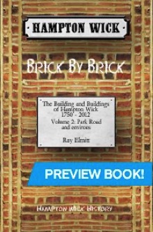
Volume 2 - West
Park Road and environs
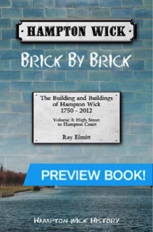
Volume 3 - Central
High Street to
Hampton Court
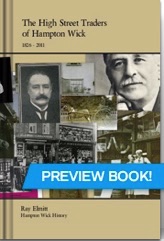
The High Street Traders of Hampton Wick
A fascinating study of Hampton Wick High Street which, although less than 400 metres long, has been host to more than seventy shops and pubs. In this comprehensive review of the period from 1826 to the current day, the author has traced every establishment, listing the shop-keepers and their trades and providing a series of reminiscences and anecdotes extracted from several sets of local memoirs as well as the more than twenty five interviews he has conducted during his research. Illustrated with over 500 photographs, maps and contemporary adverts.
178 pp (150 x 230 mm) perfect bound black and white £9.99
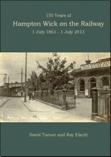
150 Years of Hampton Wick on the Railway
On 1 July Hampton Wick 2013 celebrated 150 years of being connected to Britain’s railway network. Opened by the London and South Western Railway in 1863, the line between Twickenham and Kingston filled a gap in the company’s network and shaped the history of many of the towns and hamlets through which it passed; Hampton Wick was no exception.
16 pp (210 x 297 mm) Full Colour. Publication limited to 150 copies. £3.00
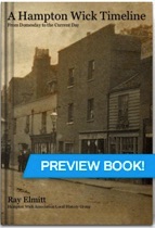
A Hampton Wick Timeline - from Domesday to Current Day
A collection of thirty-one images, postcards, maps and news-cuttings telling the illustrated story of this historic village in south west London. Each picture is provided with a caption that sets the historic context and collectively provide a brief but thorough history of Hampton Wick.
66pp (150 x 230 mm) perfect bound black and white £5.99
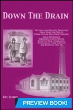
Down The Drain
Based on the original Minute Books of the Local Government Boards backed up by contemporary reports in the Surrey Comet, this book tells the fascinating and highly varied stories of how four local communities - Hampton Wick, Teddington, Twickenham and Hampton - each finally created their own communal solution for sewage disposal.
150pp (148 x 210 mm) full colour
Published by Borough of Twickenham Local History Society
Winner of the London and Middlesex Archeological Society Publications Award 2017
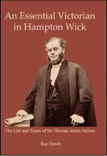
An Essential Victorian in Hampton Wick
The Life and Times of Sir Thomas James Nelson
During the Victorian Era, Central Government increasingly devolved responsibility for local health and welfare as well as law and order to locally-elected secular bodies. This devolution pre-supposed that there were individuals who were willing and able to accept the local power and responsibility. Their existence was therefore crucial since the role they played was essential to the very operation of government in Victorian Britain.
This book tells the complete life story of one such Essential Victorian - Thomas James Nelson - whose 25 years of local public service from 1860 to 1885 had a significant impact on Hampton Wick and the surrounding area. We examine his origins and early life, trace the many successes of his professional career as Solicitor to the City of London before focussing on his local public career. Finally we reveal what little we know of his private life which makes up in its surprising interest and variety what may lack in depth of material.
86 pages
26 maps and illustrations
Price £7.50 + £2.00 pp
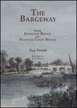
The Bargeway
from Kingston Bridge to Hampton Court Bridge
This book is about the tow path and track between Kingston and Hampton Court Bridges on the Middlesex bank of The River Thames, originally known as The Bargeway and now known as Barge Walk. It runs for nearly three miles and occupies the land between the river’s edge and the boundary of the Home Park of Hampton Court Palace. Its purpose was to provide a route for horses engaged in towing barges along the river and the close of land - which covers 18 acres - was known as the Bargeway. The route had been maintained and operated since the end of the twelfth century by the Corporation of the City of London.
The arrival of railways brought about a steady decline in barge traffic whilst the invention of the steam- and later diesel-powered tugboats finally obviated the need for horses. Thus the Bargeway lost its purpose and eventually it also lost its name. Kelly’s Directory referred to it as Riverbank, or Barge Walk from 1892 but in 1923 this became just Barge Walk.
The obvious way to organise a book about a route is to start at one end and travel to the other. This account makes the journey twice: firstly to acquaint the reader with what exists today and then to explain how it all came to be
110 pages
84 maps and illustrations
Price £7.50 + £2.00 pp
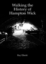
Walking the History of Hampton Wick
How to explore 300 years in 90 minutes
The idea for this book came from a guided tour I devised for the pupils of Year 2 at Hampton Wick Infants and Nusery School some years ago. To fit the school timetable it was designed to require just 90 minutes to complete and took in nine places of interest to a curious seven-year-old's mind. An adult version of the walk – on which this current volume is based – followed in 2012.
However this book has been produced in an era of Covid-19 where social distancing and government restrictions on inter-mingling preclude the use of tour guides. So the purpose of this book-version of the walk is to allow would-be explorers to self-guide themselves around the route. The original commentary script of the nine stops on the guided walk is reproduced here and it should still take 90 minutes to walk, look and read – just! But this content is now augmented with instructions on the route, information on additional items of interest to be seen along the way and details of the 14 English Heritage Listed Buildings passed en route.
66 pages
68 maps and illustrations
Price £6.50 + £2.00 pp
Sold Out
Buy Now
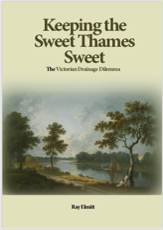
Keeping the Sweet Thames Sweet
The Victorian Drainage Dilemma
Arguably the most down-to-earth yet intractable problem facing communities and their local government institutions in the second half of the nineteenth century was simply this:
how to deal with the human waste generated by an evergrowing population?
It was a topic that occupied huge numbers of column inches in newspapers and fuelled lively and sometimes bitter debate.
How did such an unprepossessing issue come to force itself centre-stage on the attention of so many worthy and capable politicians - from both central and local government?
Why did it leave them struggling to find solutions for so long?
How was it eventually resolved?
This account seeks to answer these three questions both for Central London with its Metropolitan Board of Works and for the 27 communities in the lower reaches of the Thames from West Molesey to Mortlake.
152 pages
85 maps and illustrations
Price £8.50 + £2.00 pp
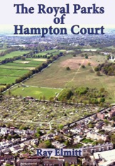
The Royal Parks of Hampton Court
From hunting ground to pleasure ground
Within the boundaries of Hampton Wick, Teddington, Hampton and Hampton Hill lie 2,000 acres of Royal Park. In the case of Hampton Wick, this amounts to 95% of the total land area of the village.
The first part of this book consists of a walking route round both Bushy Park and Home Park to acquaint the visitor with 56 individual sites of special interest ranging from Water Gardens and WW2 memorials to a Skate Park and a Model Sailing Club.
The second part recounts the two very different histories of the parks - one as a pleasure park with a magnificent palace, the other initially as a hunting park and later playing a key role in both World Wars.
The book also includes detailed accounts of ten historic buildings spanning the period 1625 - 1840
96 pages
125 maps and illustrations
Price £8.00 + £2.00 pp